-
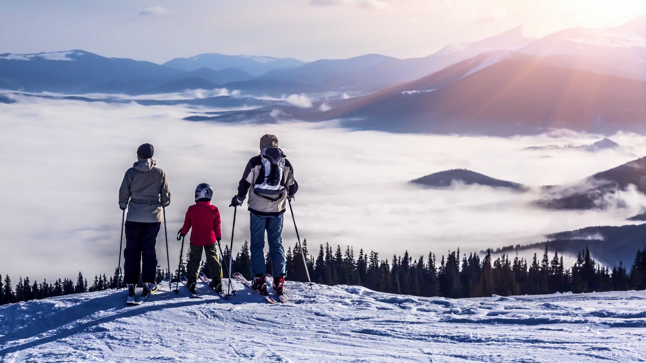
Route for beginners
PKO BP route for beginners
From number one. Polana Jakuszycka, 884 m above the sea level.
Point 3.
Crossroadat Jizera Mountains, 886 m above the sea level. The route is very easy. It starts at the Jakuszycka Polana and leads via point 1A the so-called Bodzka Route, which is located at an altitude of 868 m above the sea leveland continue over the orientation point 2A or over the track point 2 or the so-called Ryzy (840 m above the sea level with a sharp, winding approach to point 2A i.w. to point 3).
-
Inhalation routes A, B, C, D PZU LIFE
Routes with varying degrees of difficulty
From point 3 under the Jizera Mountains, 860 m above the sea level.
To points 3A, 3B,10, 9 and 11 KGHM POLSKA MIEDŹ, 925 m above the sea level
A – Simple
B – Easy
C – Interesting
D – Difficult – President
The inhalation routes consist of four parts: A, B, C, D with varying levels of difficulty, affordable except for D which requires downhill skills. All routes start at the crossroad below the Jizera Mountains. Interesting and varied from viewpoint and terrain, runs over a swamp area, in part “D” to point 11 only one-way street, with a magnificent view of the Bukovec mountain in the Czech Republic and the village of Iserka
3. Koziniec route
Route for intermediateusers
From point 3. Crossroads at Jizera Mountains, 860 m above the sea level.
To point 6. Przy Graniczniku, 840 m above the sea level.
It leads to Orzeł around Kozińc. Mostly flat. Section 5A to 6 is more difficult. However, you can choose an easiervariant that runs through 5A, 6A, 6A, 6. At point 5A you can enjoy a beautiful view of the valley of the Jizera River and of Bukovec on the Czech side. Point 5 is a so-called Pomnik Leśnika. The route runs through a mixed and beech forest. This section is called the “Day Signal Route.”
- Izerska Hall
Route for inermediate users
From point 7. Nad Kamionkiem, 825 m above the sea level.
Point 30. ChatkaGórzystów, 840 m above the sea level.
The flat, often concluded leads to the shelter “Chatka Górzystów” via the Dziczy Jar, the Izerska Hall and the fen reserve of the Izerska Valley. The owners of the sheltergive free tea to the holders of the current ski pass for the users of the cross-country skiing center trails. The season ticket can be purchased at the office of the association of Bieg Piastów.
- Route KGHM Poland Miedź
Route for intermediate users
From point 7. Nad Kamionkiem, 825 m above the sea level.
To point 15. Samolot, 995 meters above the sea level.
Burdensome, with a difference in altitude from 825 m above the sealevel on Orzeł to 998 mabove the sealevelon the so-called “Samolot”, interesting views along the way. At point 11 KGHM POLSKA MEDŹ at an altitude of 925 m above the sea level, turn right and take an attractive descent to point 12 at the Rozdroże Miedziane (960 m above the sea level). You can also choose the option with point 11 of the charmingexit to the point12 or from point 11 with the so-called “Samolot” to the landmark 15 at the Słoneczna Polana.
- Krogulec
Route for intermediate users
From point 12. Rozdroże Miedziane, 960 m above the sea level.
To point 15. Samolot, 998 meters above the sea level.
Mostly flat, especially between points 12 and 13, where the route is often blown. From point 13 at Bagno (985 m above the sealevel) the route takes a slight descent into the forest on a bump road, then a difficult ascent to Krogulec (1001 m a.s.l.) and again a slight descent around Krogulec back to point 13. From point 13 the ascent to point 14 to the so-called Drzewo Lisa and from there a flat stretch to point 15, i.e. to the so-called “Samolot.” Nice views from Krogulec to the Jizera Mountains.
- Jeleniogórska
Route for intermediate users
From point 15. Samolot, 980 meters above the sea level.
To point 19. Spotkanie, 954 meters above the sea level.
A maze of routes. Between points 15 and 16, i.e. from the so-called “Samolot” to Cicha Równia (1003.5 m above the sea level), the route is flat and gentle. Between the Cicha Równia 16 and the Kamienny Kamień (980 m above the sea level) 17 we find a descent. From stone 17 towards the rebuilt forest 18, the so-called spring route leads with characteristic snow, which is at this point until May. However, you can choose the 15-17 variant on the so-called “Maćkowiak Route”, i.e. on the route that runs through the Cicha Równia and back to the so-called “Samolot.” The route 17-18 leads to the “Drzewo Lisa” and then along the route of the TV Polonia, along the pulpit track towards the meeting point 19 (954m above the sea level) often exposed due to the scanty trees, in the last part the descent is easy.
- Wołga, Upper Duct of the Horse Cave
Route for intermediate users
From point 19. Spotkanie, 954 m above the sea level.
To point 1. Polana Jakuszycka, 864 m above the sea level.
Flat and gentle, in the last part there is a difficult descent to Jakuszycka Polana 1, which undoubtedly requires the ability to descend. This track intersects with the racetracks. We recommend the return 19-22-20B-1, i.e. via the orientation points Spotkanie 19, the fork at Cicha Równia 22, continue “Maliszewskiego Meadow” 20B to Polana Jakuszycka.
- Route of the Turów Power Plant
Route for intermediate users
From point 22. Crossroads under the Cicha Równia, 943 m above the sea level.
To point 7. Nad Kamionkiem, 825 m above the sea level.
The easy route with descent towards Orłaruns close to the fork in the road at Cicha Równia, in the further course it crosses the so-called Jelenia Łąka, which is often found due to the rare forest. Recommended and particularly recommended walk along 22A, 22B i.e. Jelenia Łąka and further along the Old Customs Way, i.e. the so-called route of the Turów Power Plant.
- Marszałkowska route
Route for beginners
From point 1. Polana Jakuszycka, 864 m.above the sea level
To point 20.Bridge on Kamienna “Łąka Maliszewskiego”, 855 m above the sea level.
Easy turn off at Łąka Maliszewskiego, the rest of the route has access areas for many routes and at the end of the route there is an off-road weather station.
- A route without grace
Route for advanced users
From point 20.Bridge to Kamienna “Łąka Maliszewskiego”, 855 m above the sea level.
To point 22.Crossroads under the Cicha Równia, 943 m above the sea level.
The route passes the mineral water source 21 at 858 m above the sea level 21 and the Waloński Kamień 21A. In the last part a one-way route with a narrow and burdensome climb to point 22.
- Route Nowa górna
Route for intermediate users
From point 20. Bridge on Kamienna “Łąka Maliszewskiego”, 855 m above the sea level.
To point 22. Crossroads under the Cicha Równia, 943 m above the sea level.
From 21, 25, 27 and 28, long ascent and descent in the forest with moderate gradient. In point 27 forgotten forest silence, from point 27 starts the descent “Droga Szklarska” to point 22.
Note: Downhill knowledge is required, as you can drive in the middle section into the Ciekoństream.
There shall be a disruptive one-way platform on the route 21 via 25, 26, 27, 28 to 22 and between points 26 and 27. From point 26 it is close to the Death Curve or down to the White Valley.
NOTE: On the routes you can meet dog sleds to make sleds and dogs easier, better get off the route
- Route of the RADIO One
YELLOW-GREEN, RADIO One
From point 1 Polana Jakuszycka, 864 m above the sea level to point 1 through point 22. Crossroads at Cicha Równia, 943 m above the sealeveland partly along the route of the Turów, TurówPower Plant and back to the crossroads at Cicha Równia then to Jakuszycka Polana, among them: Yellow: for advanced skiers, or Green: for skiers and worthy walks, also on skis.
The exit of the route is at point 1 on the Jakuszycka Polana and continues to the Dolny Dukt of Końska Jama after point 22, i.e. the fork in the road at Cicha Równia, and then to the Tury power plant line after point 19, i.e. the so-called meeting point. Return with the Upper Dukt of the Końska Jama to point 1 on the Jakuszycka Polana
Note: Dog sleds can be found on the Lower Duktroute of the Końska Jama.